The following is from the Massachusetts Emergency Management Agency Briefing at 3:00pm on Thursday:
Hurricane Lee is currently a category 1 hurricane but will become more sub-tropical has in moves into colder water. The center should track about 165 miles east of Chatham. Sub-tropical storms are more typical of a nor’easter we see here in the winter. The system will continue to spread out (widen) has it becomes more sub-tropical. Currently we are under a Tropical Storm Warning, upgraded from a Tropical Storm Watch late this morning. Could start seeing the weather effects after sunset on Friday as early as 8pm. Peak wind should start around 5am to 8 am Saturday. Sustained winds in 40 mph with gusts to 60 mph. Rain 1.5” to 2” is possible. Minimal flood surge on our coastline. This should be a 12-hour event on Saturday mostly. Sunny and dry on Sunday.
This can change depending on the track of the storm.
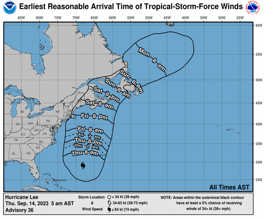 Tropical Storm Arrival Times
